Biomes are terrestrial communities occurring
over wide areas
Recognized by characteristic appearance
Associated with characteristic climates
Classified by vegetation
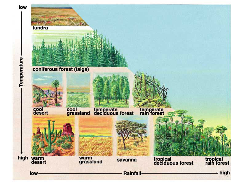
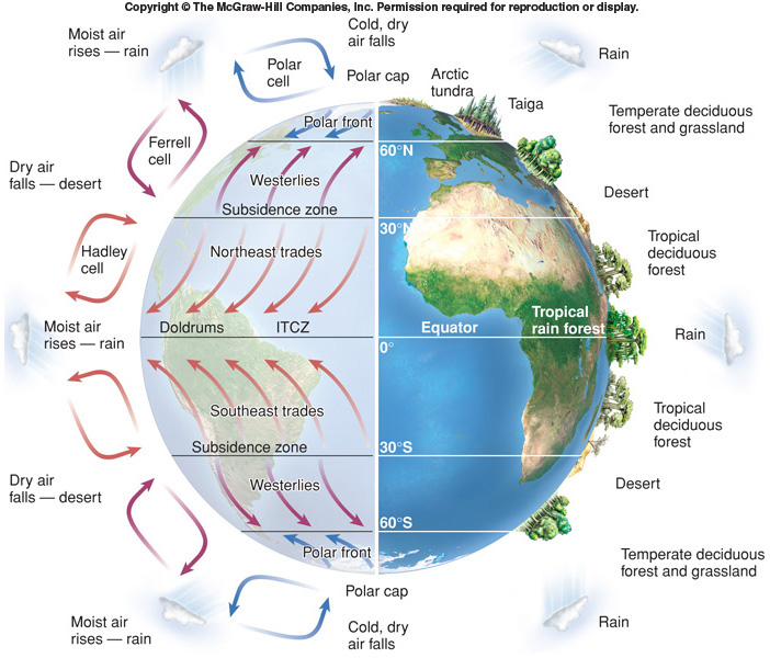
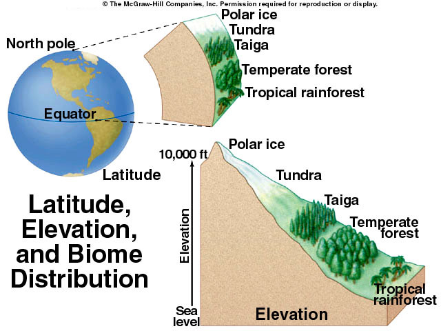
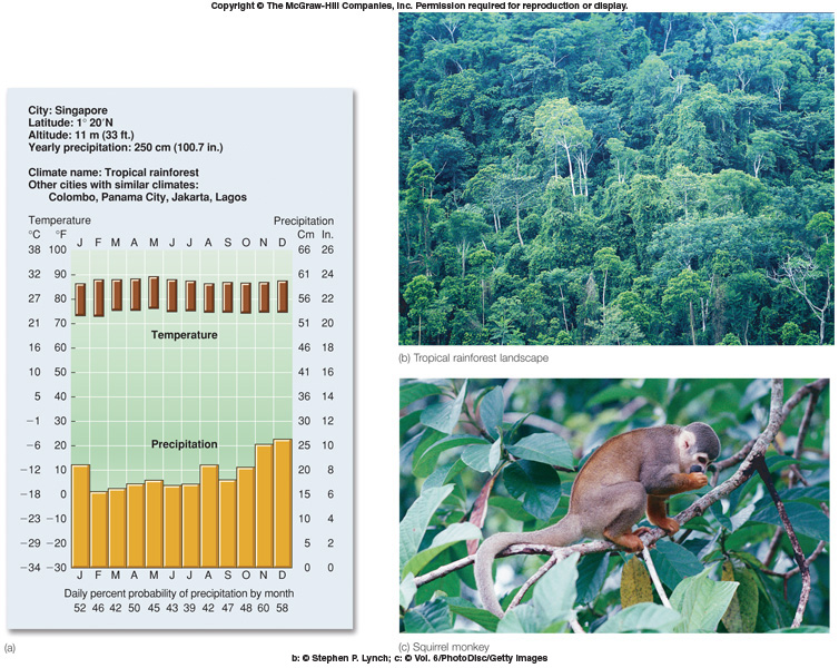
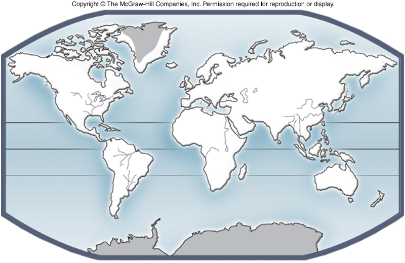
Distribution - Fig. 37.25 of biomes is a result of: Climograph
Climate - primarily determined by temperature and precipitation
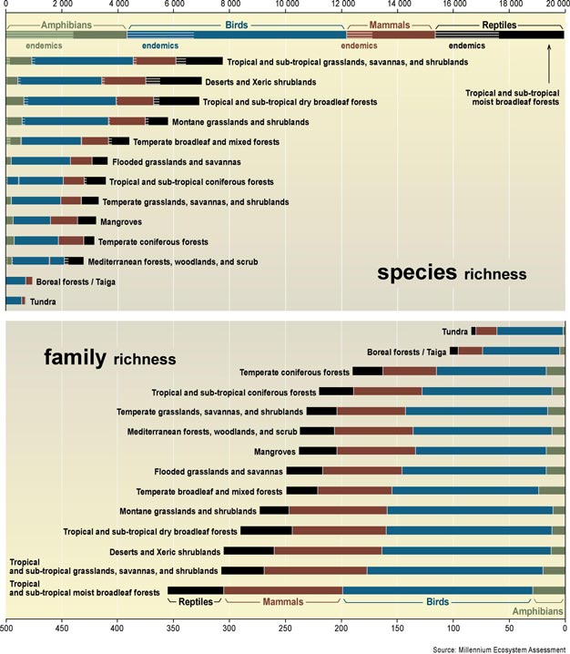
Richness
of biomes
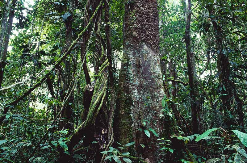
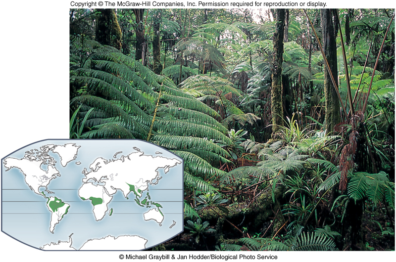
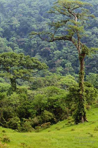
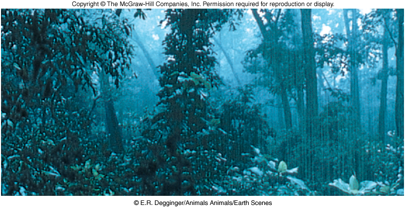
Tropical
Rain Forests and Fig. 37.26
Richest biome in terms of number of species
Substantial rainfall throughout
year
Competition great for sunlight; epiphytes
and vines common
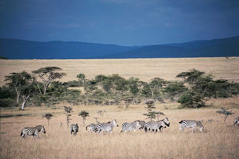
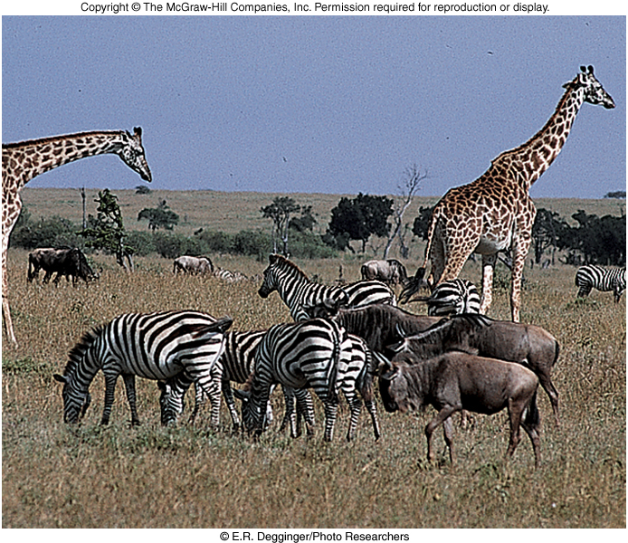
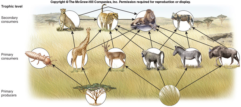
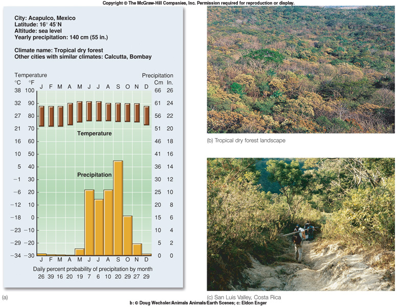
Savannas - image and
Fig.
37.27 and Map
Reduced rainfall with prolonged dry seasons
Open grassland with scattered shrubs and trees
Maintained by periodic fires - fire adapted
Large herbivores and their predators dominate Food
web
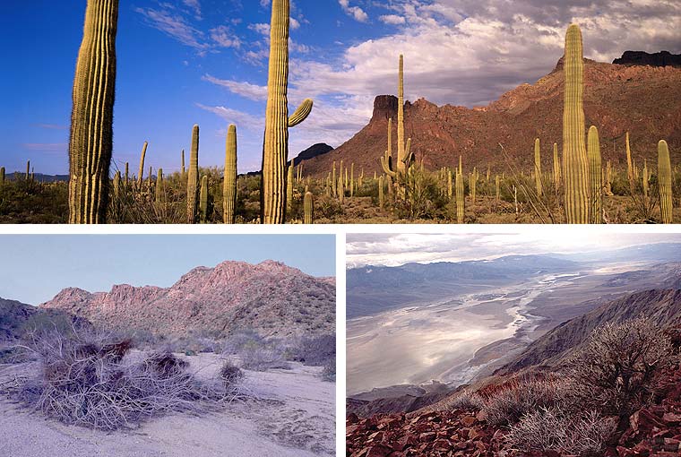
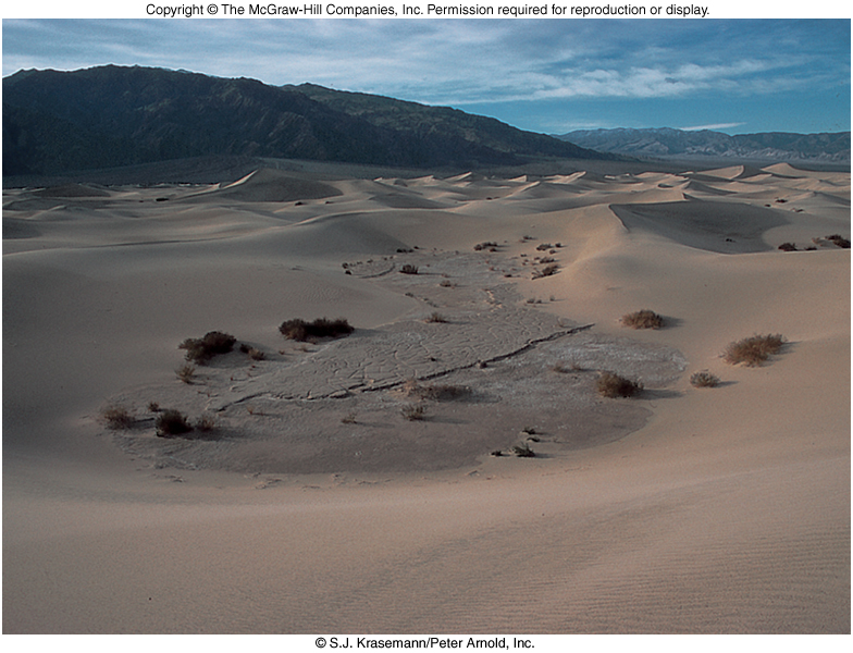
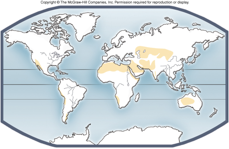
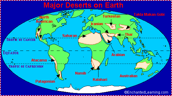
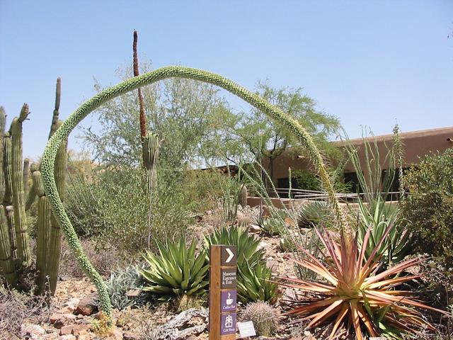
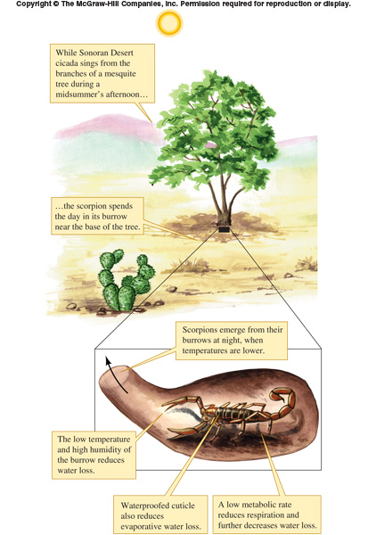
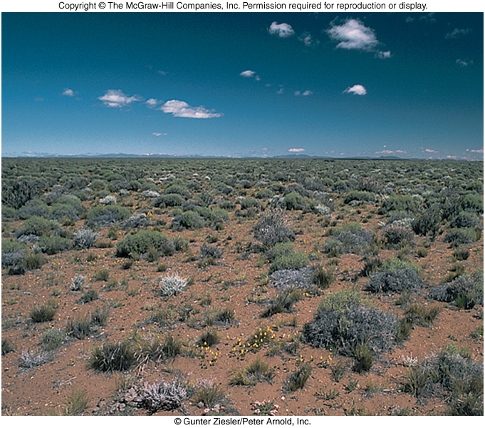
Deserts - Image and
Fig.
37.28 Map
Extremely low rainfall
All great deserts at or near 30 degrees latitude N or S - Map
Other major deserts at continental interiors
Other deserts on leeward side of mountain ranges
Rain shadow effect: drier on leeward side of mountain
Both cold and hot deserts
Special adaptations by both plants
and animals
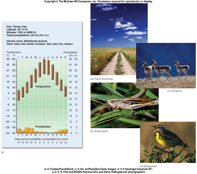
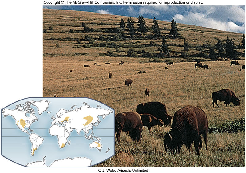
Temperate
Grasslands - Image and
Fig. 37.29
Grasslands also called plains or prairies
Maintained by grazing
(large herbivores) and periodic fires or become forest - fire adapted
Most grasslands in US now converted to agriculture
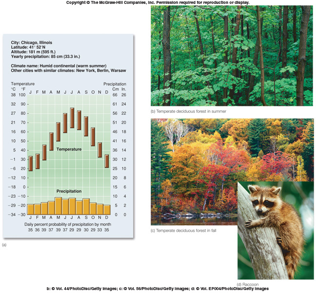
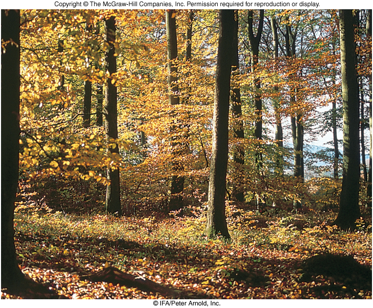
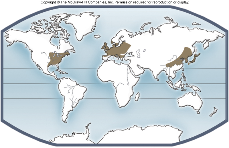
Temperate Deciduous
Forests - Image and
Fig.
37.30 Map
Dominated by deciduous trees like oak, hickory, elm, maple, ash -
lose leaves in winter
Moderate rainfall
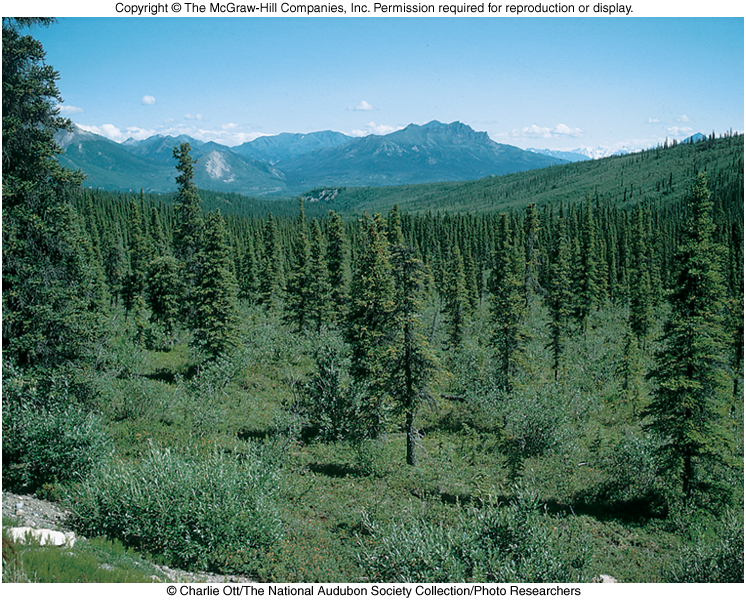
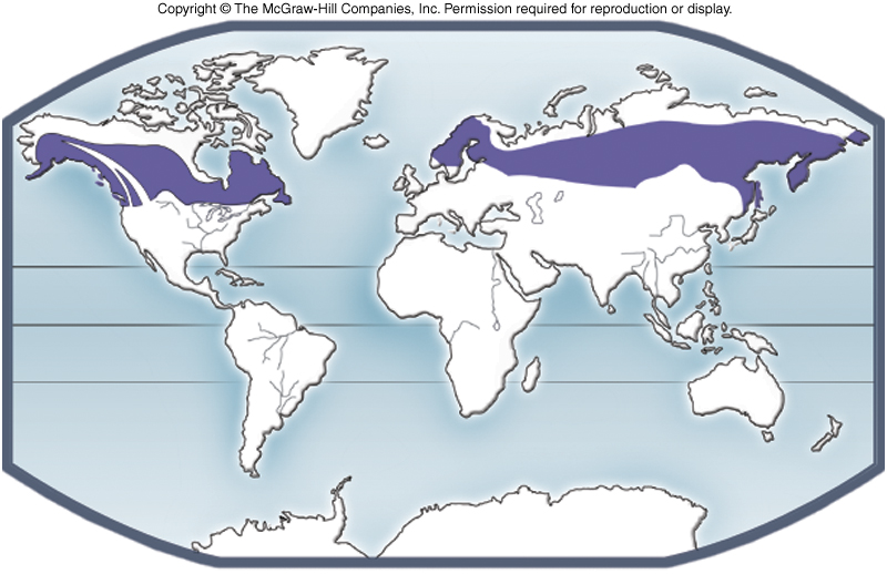
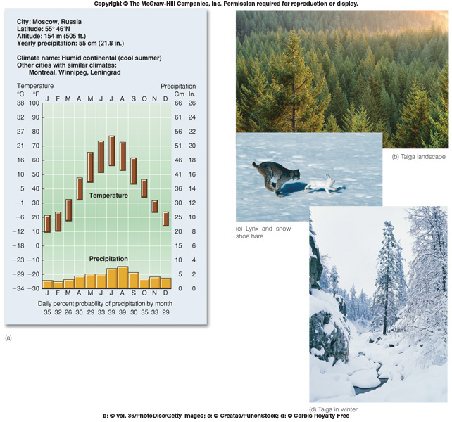
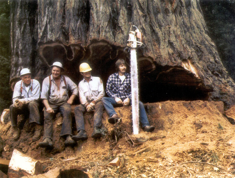
Taiga or coniferous forests - also called boreal forests -Fig. 37.31
Northern coniferous forests of Eurasia and
North America
Long, cold
dry winters
Largest terrestrial biome
Very short growing season
Now being logged at a tremendous rate
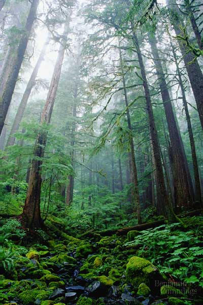
Temperate Evergreen Forests - Image
Cool weather, dense fog, high precipitation
On coastlines as in northwestern U.S.
Large evergreens, many epiphytes
Very important timber
- little old growth left
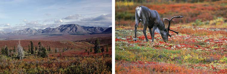
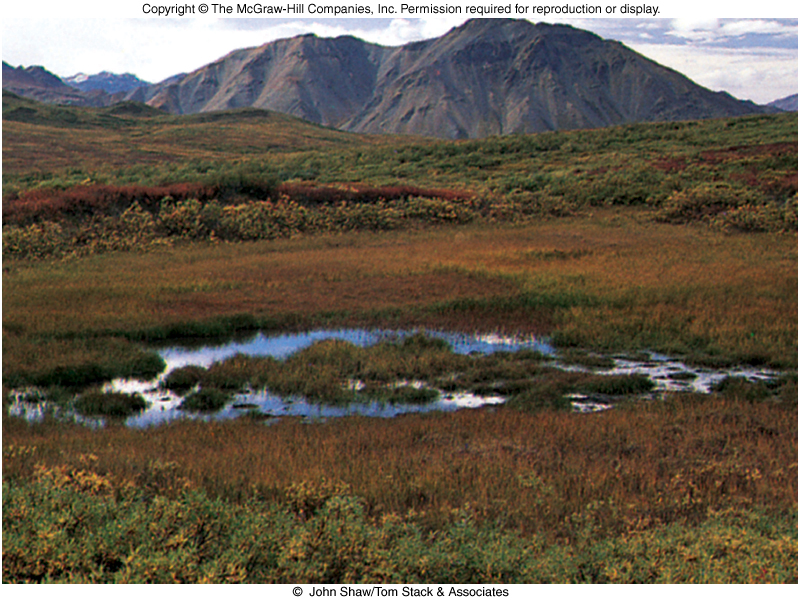
Tundra - Image and
Fig.
37.32 Map
Bitter cold, high winds
Very low
precipitation
Very short growing season
Permanent ice, permafrost, underlying surface
Arctic (far north) and high mountains.
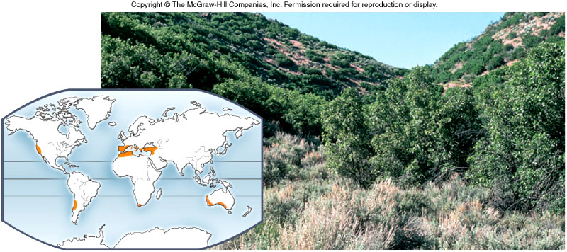
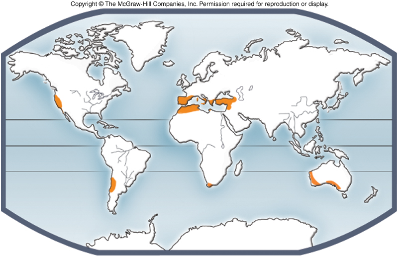
Chaparral - Image and
Fig. 31.33
Spiny evergreen shrubs
Climate dry in summer Map
Maintained by fire,
needed for some seeds to germinate - fire adapted
Polar Ice
and Fig.
37.34 Map
Ice caps at north (Arctic) and south (Antarctic) poles
No precipitation, fresh water scarce, life limited to coasts
Only bacteria, algae, small insects in Antarctic interior
Tropical
upland forests and Fig 37.35 Map
Alternate
wet (monsoon) and dry periods
Many trees lose leaves in dry period.
Semidesert Fig. 37.36 Map
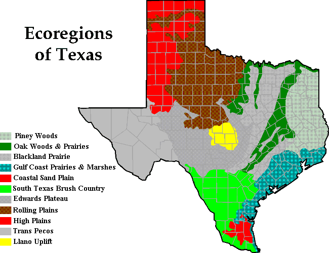
Texas
Ecoregions from Texas Parks and
Wildlife